Aerial view of a flooded town.

Is it possible to move from flood management to flood resiliency?

Headshot of Jeff Crofton of Advisian.

Jeff Crofton | Director, Surface Water Engineering, Calgary | 18 August 2017

Since the beginning of the 20th century, large flood events appear to have become more frequent, more damaging and more costly. We can only estimate that the frequency of flooding is increasing since flood records were rarely kept prior to the 1900s.

A large part of the increase in flood damages is our transition from a broadly distributed agrarian population to a substantially larger and growing urban population that lives in centres often located on or near the banks of major river systems. 

The trend of increasing flood damage costs can be expected to continue in the coming years due, in part, to changing climate patterns, lack of long-term historic discharge records and to increasing urbanisation. The resulting increase in impervious surfaces and encroachment on the waterfront, have all played a major role in increasing the pressure on waterways, squeezing and confining their floodplains beyond natural equilibrium. Floods cannot be prevented and experience has shown that trying to contain the flood flow in a narrow channel is not only extremely expensive, but it changes the river channel and floodplain and puts us on a never-ending process of trying to increase the containment.

River containment has many impacts, only one of which is the potential to increase the river bed level such that it is higher than the surrounding land. If a river breaches the flood protection dykes where the bed is higher than the surrounding land, the river will form a new channel in an area where there has been no river in living memory. New Orleans is a prime example of this, with many of the urban areas being built below sea level and protected by a series of dykes. When those dykes become overwhelmed, the consequences can be devastating, as was seen in the wake of hurricane Katrina. 

Man-made flood protection structures all have a lifespan and suffer from the dichotomy of balancing protection while maintaining reasonable capital cost. When the structure is approaching the end of its service life, even the best constructed structures have the ability to fail. These structures introduce a false sense of security in the otherwise flood-prone areas behind the dykes.


The financial burden of flood management

The most logical approach to minimise flood damage and to reduce the cost associated with flood damage is to limit construction within natural floodplains. This will help reduce the pressure on rivers in the future, but the fact remains that many of our current floodplains are already overly constrained. Most of the settlements along these rivers were constructed long before the impacts of flooding were well known, and the challenge of now protecting them puts increasing pressure on residents and government agencies.  One of the paramount questions becomes, “Who is at risk, and from what?” The delineation of the flood risk zone is not as straightforward as one might think.  

In Canada, the federal government initiated the Flood Damage Reduction Program (FDRP) in 1975 and paid for the mapping of the flood extents in many urban centres. Due to changing financial priorities, the federal government terminated the program and entered into agreements with the provinces to manage and finance their own flood hazard mapping. Conflicting pressures for taxation dollars at the provincial level meant that where programs were developed, there was often no consistency in the approach. Where one province set the 500-year return period as the flood of record for delineation of the flood risk zone, another may have chosen the 100-year period, and so on. 

However, even with flood hazard maps available, many of the flood-mapped municipalities choose to ignore the flood hazard maps and, for increased tax revenues in the shorter term, allow developers to build within the flood hazard zone. As rivers are a provincial responsibility, some municipalities insisted that the provincial government compensate them for the flood damages even if the new developments are located within a previously known flood risk zone. In doing so, they transfer the financial burden to the rest of the population in the province rather than bearing the cost solely at the municipality level. 

The cost of flood damages in Canada from large floods between 2005 and 2013 was about $12 billion, on average $1.3 billion per year.

The 2013 flood in Alberta alone caused more than $6 billion in damages and highlighted the need for additional multi-million dollar expenditures to construct flood prevention and diversion infrastructure to protect urbanised areas in the future. Our society cannot continue to bear the high costs of damages, which will increase in coming years if the trend of climate change continues. So how can we as a society and as flood management professionals, be more pro-active, more efficient, more frugal with taxation dollars?

Moving to flood resiliency

The ultimate answer to becoming resilient to the impacts of flooding is to remove anthropogenic influences from the floodplain. In addition, implementing sustainable urban development and low impact drainage designs can help steer the effects of increasing perviousness in the right direction. 

These changes will take generations to implement, but in the short term we can start the discussion by better understanding river processes and using specialised tools to help plan and develop emergency response procedures. Emergency response is a delicate balance of logistical coordination and knowing when and where to respond to provide the best level of protection, and is the key to an effective response plan. 

The current picture of emergency response and its challenges 

After the 2013 flood, some provinces, such as Alberta, recognised that municipal governments may not have lived up to provincial flood management expectations from a land use point of view and have initiated new legislation that transfers the regulation of land development within flood hazard areas from the local government to the provincial government. 

In Alberta, as in many jurisdictions, the standard for floodplain delineation is the development of a hydrotechnical model using a one-dimensional platform. This tends to work well in areas where rivers are highly incised in deep valleys, but fails to describe adequately what happens to floodwaters in a flat land area where rivers have freedom to roam once they surpass the bank level. 

In addition, most flood models are developed to describe the level of the flood surface during standardised return period events: from the 1 in 2 year, to the 1 in 100 year. Typically the set of return periods evaluated may include the following: 2, 5, 10, 25, 50 and 100 years. What is difficult to determine in the context of emergency response, is how one should proceed for a return period that lands somewhere between these bands… or beyond the highest evaluated. 


A compounding challenge for emergency responders is being able to understand what happens in the context of time as the flood is approaching and progressing.

The waterRIDE™ advantage

There are many products on the market today that provide the ability to visualise and animate a modelled flood scenario. With the exception of waterRIDE™, however, there are none that allow on the fly reassessment of the flood scenario for any and all flood conditions between the standard modelled scenarios. 

This is best illustrated through the following example:

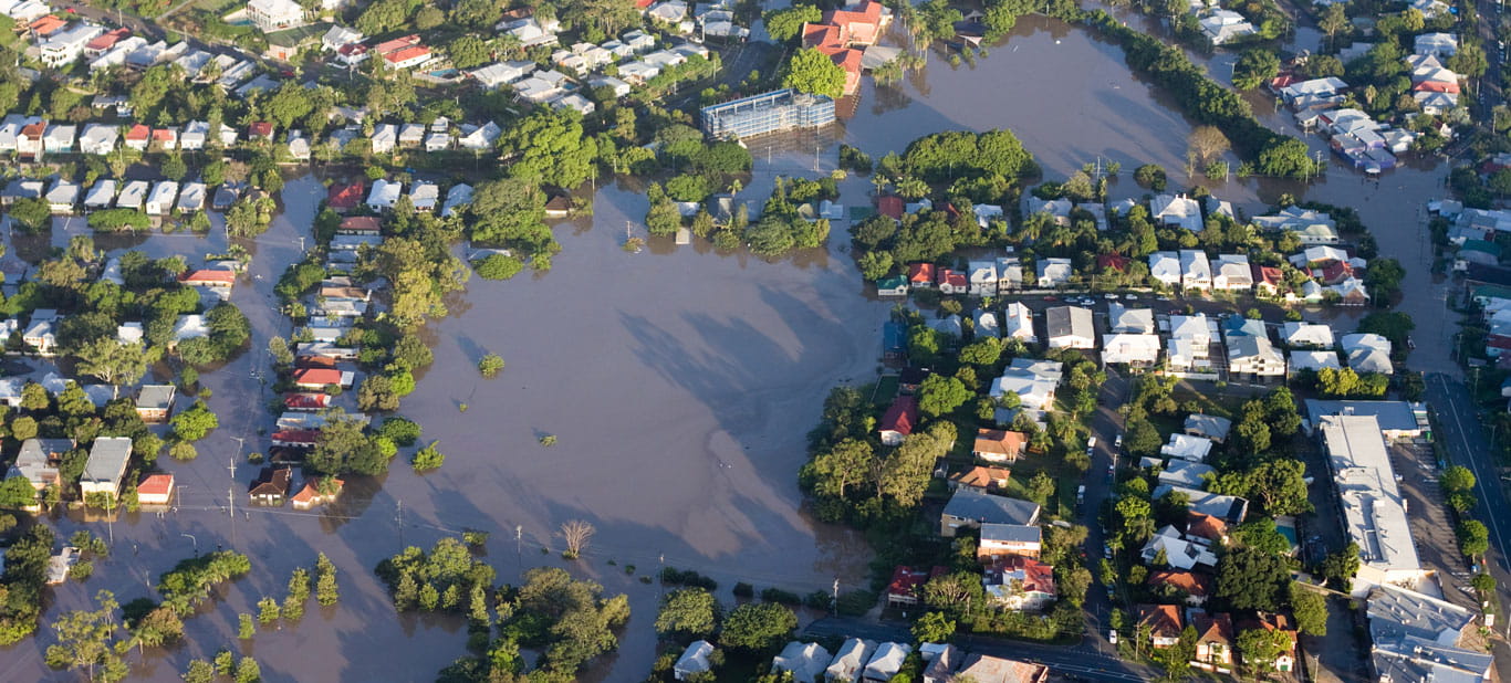
A town built next to a major river has a current flood model that has been assessed for standardised return periods and has a general map of what the flood zones are in the event the flood of record were to occur. Typically these flood risk maps show the 100-year event water surface level. 

One morning the residents of the town awake to reports on the radio that large amounts of rainfall are predicted for the coming days and, with hot weather in the mountains, snow melt is also on the rise. Flooding is a real concern. 

As an emergency response team, this is a recipe for failure. There is no idea how much water is coming, no idea where to start with the evacuation or barricade process, or whether to call an evacuation at all. waterRIDE™ was developed to provide a high level of visualisation and re-assessment of scenarios just like this. 

With the results of the flood model loaded into waterRIDE™, the emergency response team can easily enter a forecasted rainfall, a forecasted river stage and within seconds a new water surface will be projected. 

How does waterRIDE™ do this? 

waterRIDE™ uses the predetermined data from the flood model to interpolate the rivers response to a forecast event. Using internal GIS capability, waterRIDE™ will then overlay this new information across any number of spatial datasets that are available. In addition to the new water surface delineation, waterRIDE™ can use internal temporal subroutines that allow queries to be run. This can take any form the ERP team requires, such as:

  • Time of closure of important evacuation routes
  • Depth of water over the roadway at any point
  • Depth of water over the main floor level of houses in the floodplain. 

The list goes on and is only constrained by the available data that can be provided. 

As a result of its fully integrated GIS functionality, waterRIDE™ can provide thematic maps based on full Boolean search criteria. For example, displaying all points in the field where water depth is greater than 1m or where velocity is greater than 1 m/s. These thematic maps are produced instantaneously, which allows ERP teams to immediately prepare a response based on greater levels of intelligence. 

Using a streetlight approach, waterRIDE™ can display maps of allocated evacuation routes shaded by level of service, time to closure or time to reopen as the waters recede. Understanding this temporal aspect is important to deploying crews in the field to manage the response where and when it makes the most sense efficiently. 

waterRIDE™ links to the most commonly used hydraulic analysis models and allows the user to quickly extract all those values that are so important in flood forecasting and those needed in model development and debugging. In flood forecasting, some of the specific strengths of waterRIDE™ are its ability to produce flood surfaces in a few seconds, implement a range of forecasting techniques and provide powerful visualisation – all while being simple to use and operate by a person who is not a hydrotechnical specialist.

For floodplain management and planning work, waterRIDE™ automatically maps the floodway, flood fringe and flood storage, from a terrain model and hydraulic analyses, as per user-specified criteria. The built-in flood damage estimator allows the user to estimate the anticipated flood damage for any flood level, which can then be used to do a cost/benefit analysis of various floodplain management options.

The fast and powerful visualisation in waterRIDE™ is effective for providing quick and descriptive information during a flood emergency. With the dynamic scenario analyses, flood emergency managers can obtain critical information, such as the time available for evacuation along specific routes and how long the evacuation routes will be inaccessible. It will also show the spread of the flood over time, to allow the flood emergency managers to prioritise areas for evacuation, and to illustrate the potential access and risks to critical infrastructure such as hospitals, water treatment plants and sewage treatment plants.

As with any floodplain planning and flood emergency, the most important piece is fast and easily understood visual communication – a picture really is worth a thousand words in a crisis situation.

One of the primary strengths of waterRIDE™ is visual communication, which allows the fast production of high-quality illustrations of flood extents and depths for any time step of a modelled flood condition. This provides local governments and stakeholders with quick and easily understandable answers that can be provided in a very short time to both plan for and avoid disaster and better manage the inevitable flood to minimise damages and the cost thereof.

Topics

Headshot of Jeff Crofton of Advisian.

Jeff Crofton

Director, Surface Water Engineering

Jeff is the Director of Surface Water Engineering for the Americas and has over 20 years’ experience in the areas of hydrological and hydraulic modelling and analysis, the design of intakes and other hydraulic structures, river engineering, scour abatement, dam design, as well as integrated surface water management for clients that span the private, municipal, provincial and federal sectors. Jeff works closely with the Global Advisian Water Team to bring value to clients locally and internationally who face increasing pressures to secure water for their projects and use natural resources in an integrated and efficient way to promote sustainability and social respect.